Land Surveying
Sun Country Engineering has specialized in land surveying for over 40 years. We have worked in the past with both private and public clients and no job is too large or too small.
Surveying or land surveying is the technique, profession, art, and science of determining the terrestrial two-dimensional or three-dimensional positions of points and the distances and angles between them. Surveyors measure and compare property records to determine the physical location of roadways, private and public property boundaries. In practical application, we create mapping products for many purposes in the land use business.
Boundary surveys are made to delineate a property’s location in relation to monuments and other adjacent properties. Often, boundaries are disputed as to the precise location. Often, two neighboring property owners desire to move the legal boundary between the two.
New construction will typically start with a topography survey, a map of the physical properties of a particular lot or parcel as a base map for design and land use planning. Some properties slated for development can be split into a few or many new parcels, such as a 3-lot partition or a multi-unit subdivision. These survey documents are filed with the County Surveyor to keep a perpetual record of all properties in the county.
Topographic Surveys
A survey to locate natural and man-made features on a particular parcel of land, essential for development projects.
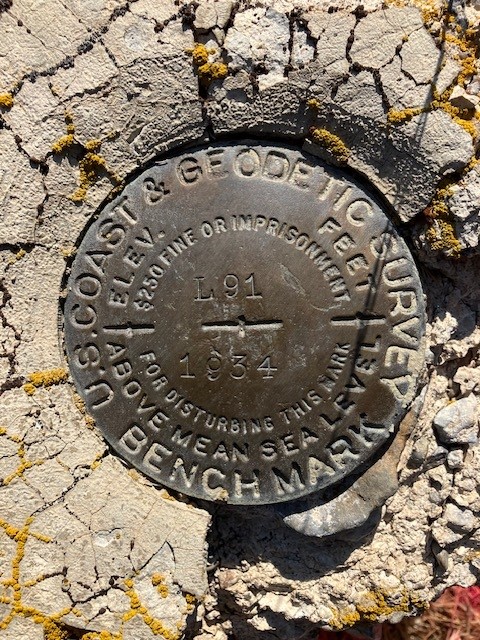
Property Corner Locations
We can locate necessary lot corners for building a fence, selling or buying a house.
Property Survey
Determine property corner locations and verify existing corner monuments. Re-set any missing corner monuments.
Boundary Survey
Determine, from survey and deed records, and location of existing corner monuments, the boundaries of a property. Re-set any missing corner monuments.
Staking for Foundation and Construction
Mapping out improvements on the actual site where the building will take place. Stakes in the ground for contractor to correctly place foundation on subject property.
Staking for Residential Construction
Staking individual lots for custom home building.
Property Monument Locations
Search for and flag existing property corner monuments.
Partitions
Preparation of a two to three lot subdivision to jurisdictional requirements to create new Lots or Parcels, along with marking new Lot/Parcel corners with survey monuments.
Lot Line Adjustments
Providing associated applications and design drawings for moving a legal lot line.
FEMA Elevation Certificates
A community’s permit file must have an official record that shows new buildings and substantial improvements in all identified Special Flood Hazard Areas (SFHA) are properly elevated.
ALTA Surveys
A detailed survey prepared in accordance with the standards specified by the American Land Title Association (ALTA).
LOMA Letters
A Letter of Map Amendment (LOMA) is an official amendment to a property’s location in relation to the Special Flood Hazard Area.
Solar Setback Surveys and Calculations
A survey and corresponding calculation to determine building setbacks that do not impede on neighboring solar rights.
FAA Cell/Radio Tower Certifications
Geodetic position and height determinations.